Suilven in Scotland / Highlands – 360° Panorama and the long way to the top
Diesen Beitrag auf Deutsch lesen.
The day we reached out for the summit of the Suilven was without a doubt the hardest during the holidays in Scotland. I probably will never forget this day. It was worth all the effort and unbelievable beautiful. The view from the top of the Suilven is hard to describe. Therefore I’ll give you the 360° panorama straight away. It is best viewed in fullscreen mode.
360° Panorama taken on the summit of the Suilven
As you can see we had a lot of luck with the weather that given day. The sun was basically out all day and I was able to take these shots.
The hotspots show pictures of the surroundings (the photos are up to 2 MByte big). That includes the Ardvreck Castle in Loch Assynt and a leaping salmon in river Kirkaig. I also named the most prominent summits that you can see in the 360° panorama – Quinag, Canisp and Cul Mor. To be able to read it properly you need to zoom in a bit. Behind one hotspot is a noise hidden – it is quite easy to find.
If you do a right click within the panoramic photo you can change the view. The most prominent is probably the so called Little Planet.
A special thank you to Carmen. She helped me to improve the final panoramas a bit.
Some Details regarding the pictures
To be dead sure it all works out I shot a photo every 40 degrees. My biggest fear was actually to run up all the way and to ruin the panorama pictures because of a silly mistake.
One row up and one row down makes it 18 pictures in total. But I also used bracketing to shoot every picture within the EV stops 0, -2 and +2. The reason was to use HDR technologie for the final 360×180 picture. So in total there are 18*3=54 picture per panorama. The good thing about this approach is that you can see quite a lot of detail even at some point I had to shoot directly into the sun.
The stitching itself was done with the open source software Hugin. Zenith and especially Nadir (visible tripod) were fixed using GIMP. I also used GIMP to get rid of a few shadows – including mine.
The final 360×180 panoramas are in total about 135 megapixels big. Therefore you can zoom in quite a bit without loosing to much details.
The way to the top
It’s about 22 km to the summit of the Suilven. You cannot go there by car and have to walk through wilderness. Our starting point was Lochinver because the house we rented (also a 360°) was there.
We did start early in the morning and the weather forecast was promising. We still were prepared for the worst and it is quite chilly at 7 am.
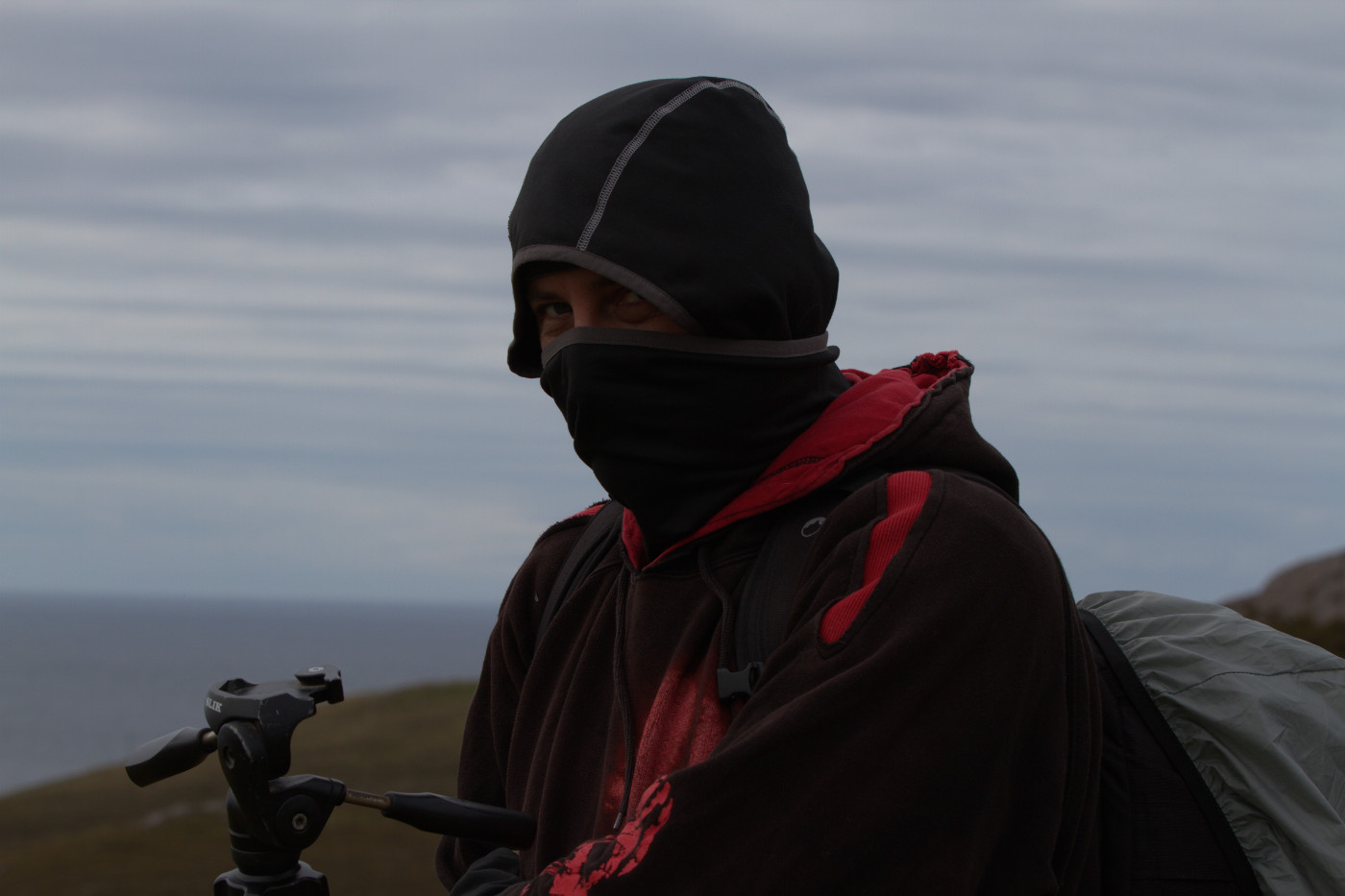
It is quite chilly in the morning (© Jeanette Hanna)
To the Suilven (right hand side) – we started early in the morning
In our backpacks we had water, food full with energy and so but. On top of that I had my tripod, Canon EOS 7D, panorama head, Sony RX100 III and a Tokina 10-17mm fisheye. In total I had roughly 9,5 kg on my back. In the beginning it is actually a piece of cake but with every kilometre it feels heavier.
The first 7.5 km you walk on a path that is used by the rangers. The walking is quite easy. As soon as the sun came up we were amazed by the beauty of the pure nature there. To reach the bottom of the Suilven you have to walk around a few lochs and lochans and cross a river (there is a bridge).
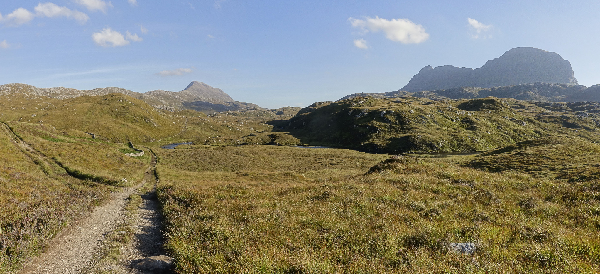
In the beginning you walk on a rather nice path
I want to mention the Assynt Foundation. They bought 44.000 acres of land to preserve this wilderness that we were walking through. This is amazing – I think more regions should do something like this.
After 7.5 km you leave this path. The bottom of the Suilven you reach after roughly 2 km. But it is much more difficult to walk. Bog, mud and so on has to be dealt with. Once you reach the bottom of the Suilven you probably are a bit riddled how to get up there. The red line marks the ascent.
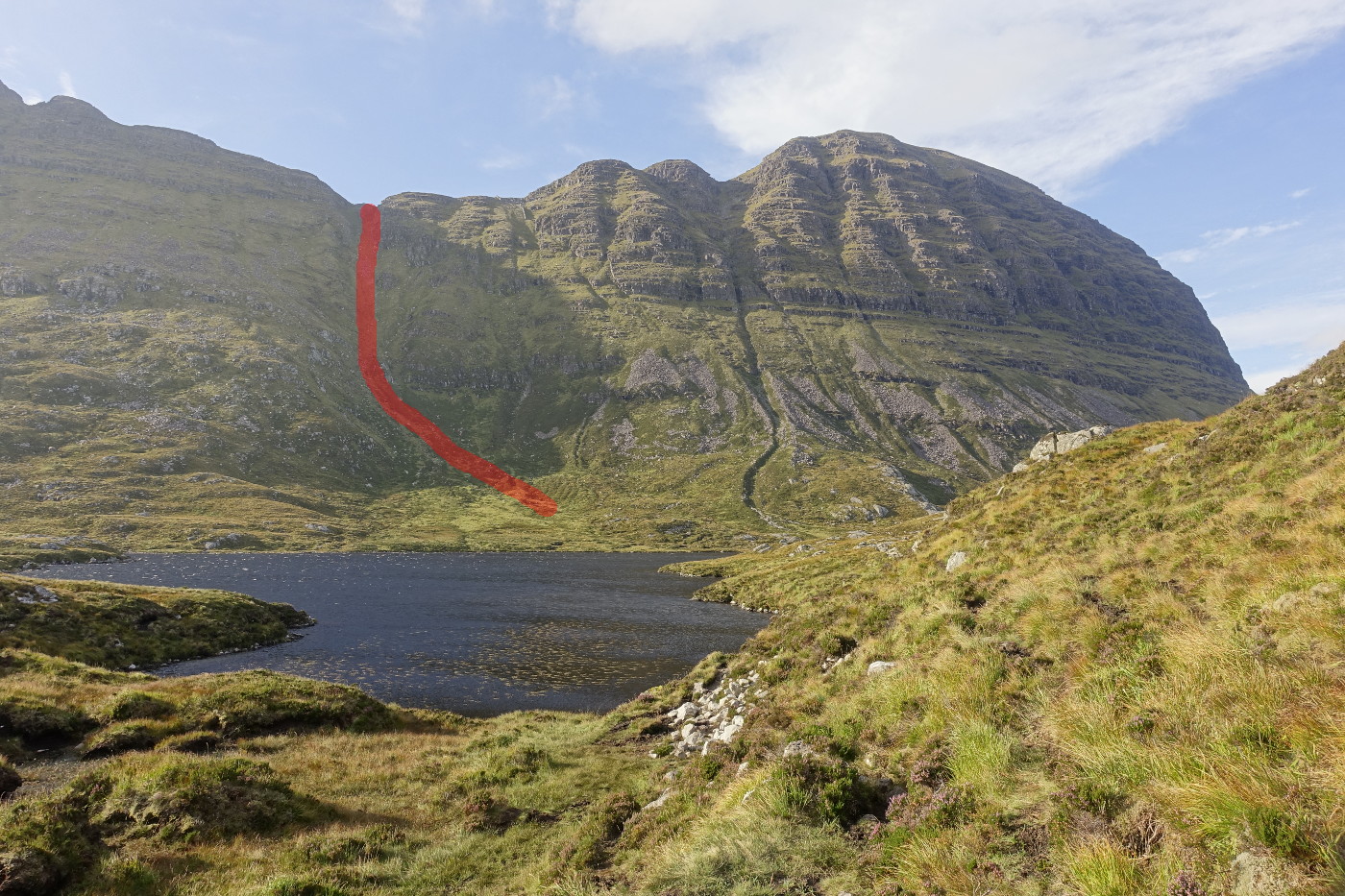
Way to the summit of the Suilven
It looks like an impossible climbing contest but it is just a rather steep walk up there. You only have to pull yourself a bit up on 2 occasions. But you have to watch your step. From the bottom of the Suilven to the summit you walk another 1.5 km.
Finally up there I was quite riddled. There is a wall almost on the top of the mountain just underneath the summit.
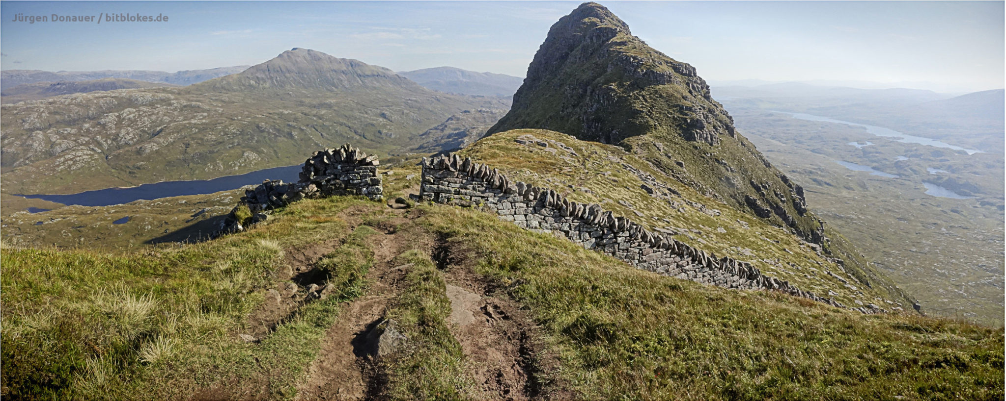
The rather useless wall on top of the Suilven
After a bit of research we found the theory that in times of high unemployment the landlord paid a few guys to build this rather useless wall up there. Well at least they had some work and therefore a bit of money and did not question the sense or nonsense behind it.
The long way back
The view on top is amazing and you could stay there forever. But at a certain point we had to turn. After I finished the photos for the 360° panoramas we went back.
The descent was OK. Well after 1.5 km down the feet are somewhat wobbly. Back at the bottom of the Suilven we knew that from now on we have another 10 km to walk. First back through the bog and mud and after that the 7.5 km on the path.
In total it took us 9.5 hours. Of course we had a break once in a while for water, food, rest and taking pictures.
In between the Suilven and the path I had a small incident and was actually lucky. I slipped and could slow down the fall with a walking stick. The stick itself wasn’t too happy about the slip and snapped. I was under the impression that they are built a bit stronger. I weigh about 80 kg and that is not really very heavy. I was glad that this did not happen during the descent from the Suilven as I had my full weight once in a while resting on the walking stick.

Broken walking stick
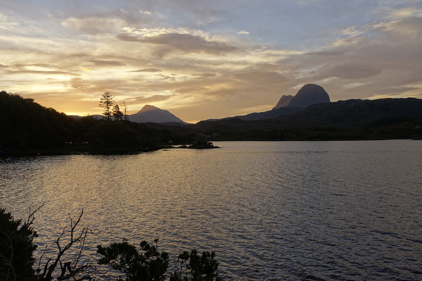
It was not easy but to walk up to the summit of the Suilven was absolutely worth it. I would do it again. As I said we were lucky and had the perfect day to do this. With a rather nice breeze the midges left us alone as well. Late afternoon we reached the starting point and saw that there were a few clouds around the Suilven. It almost looked like the mountain enjoyed a cigar after a long working day. 🙂

Suilven and clouds
Our profile
My friend Clive has one of these walking gadgets. It counts the distance (more or less) and he shared the data with me. So you get an idea in case you plan to do this yourself.
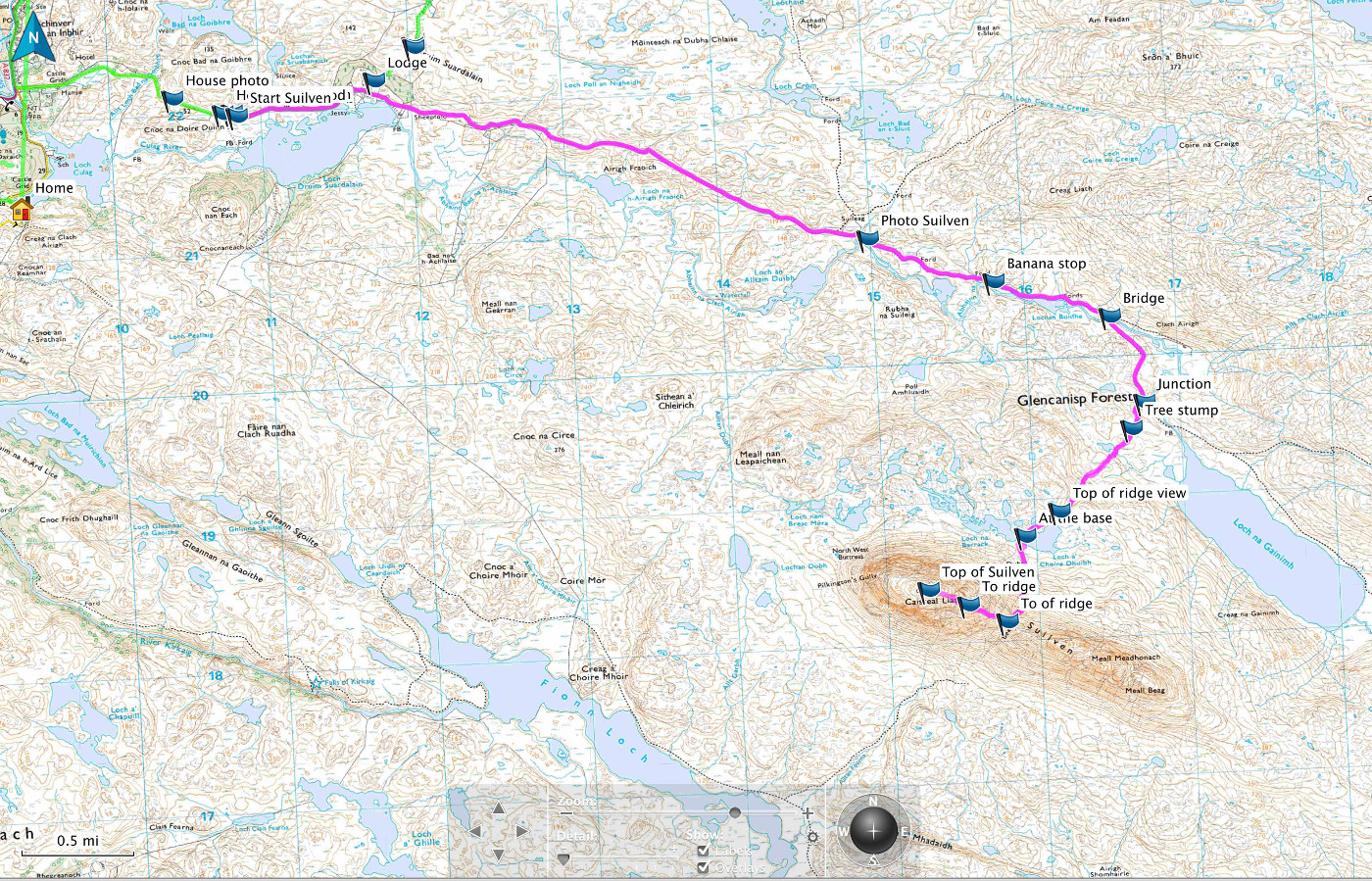
The way to the Suilven from Lochinver (© Clive Hanna)
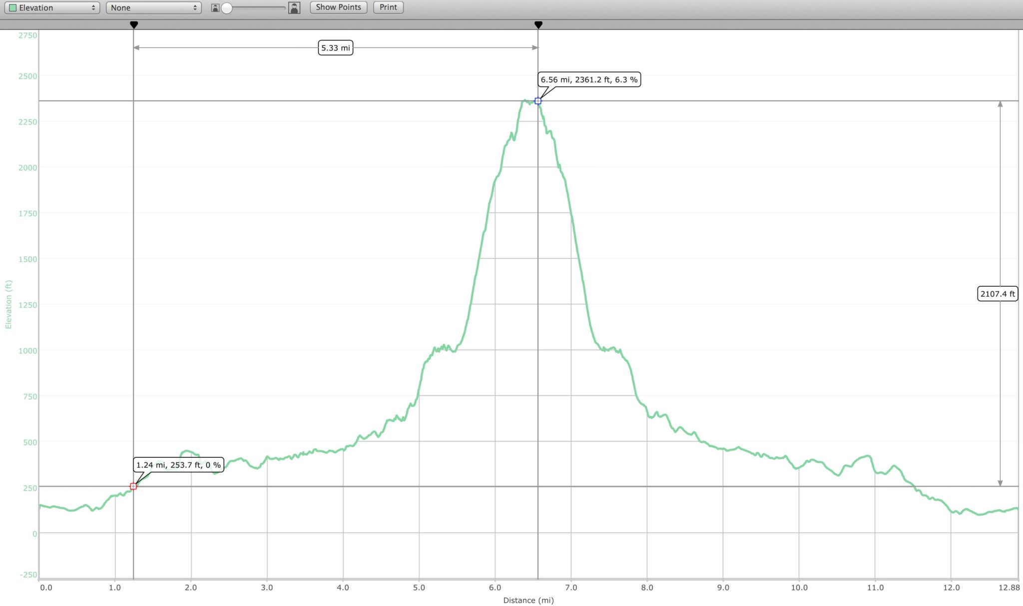
Our profile (© Clive Hanna)
Special Thanks!
I want to thank my friends Jeanette, Trudy, Clive, Peter and Andrew for this special holidays and this unforgettable day.
Parts of the equipment I used